
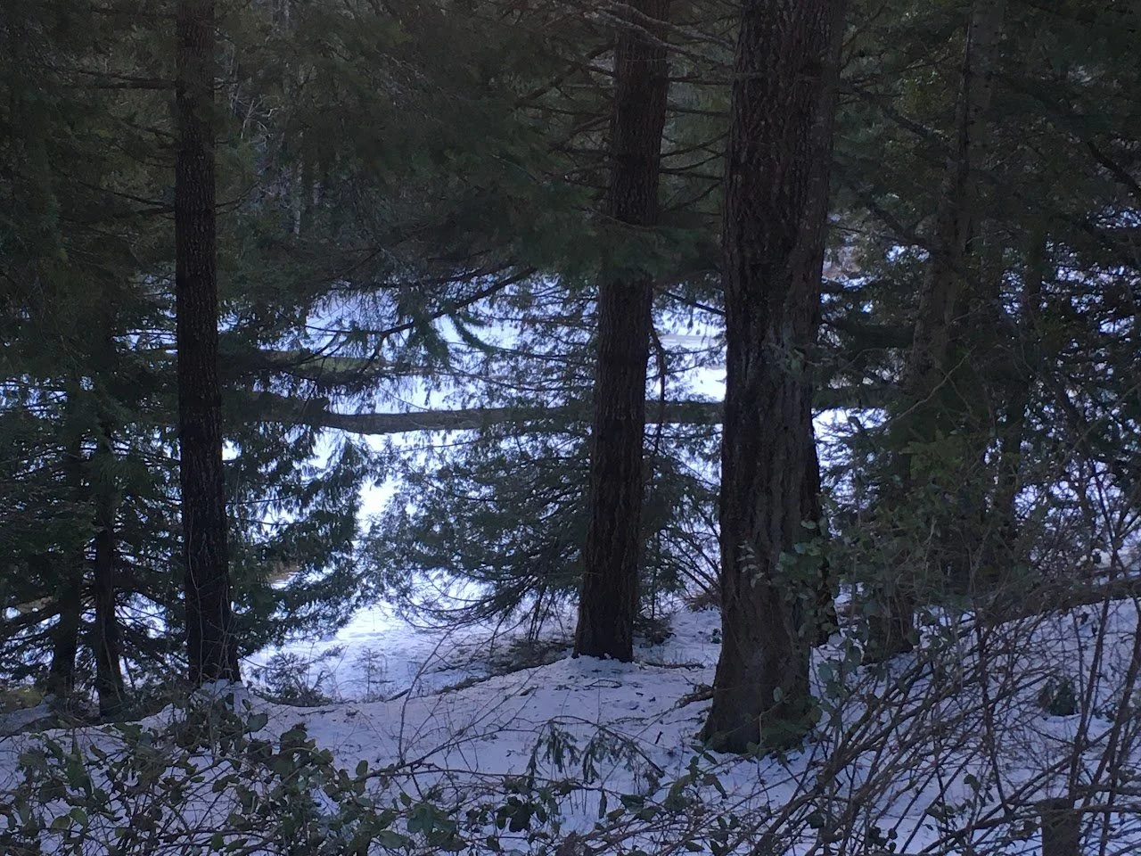
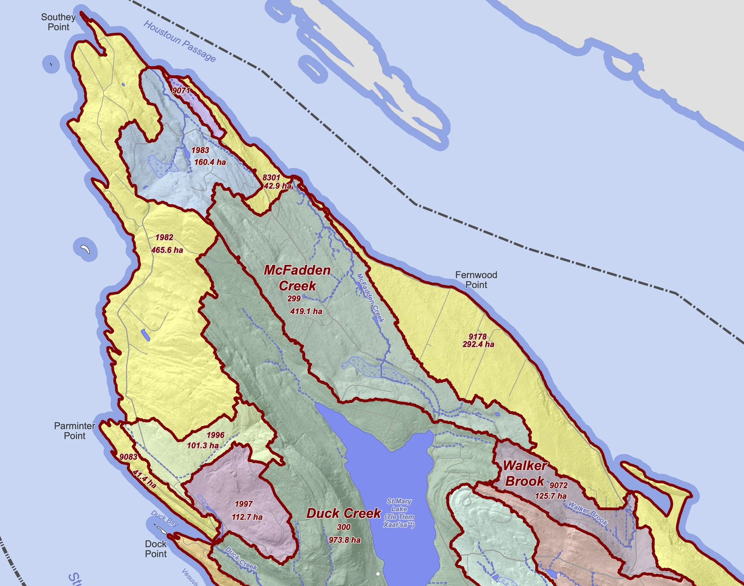
The McFadden Creek Watershed (MFCK) is a mid-sized (419 hectare) watershed on the north end of Salt Spring Island that receives approximately 4 million cubic metres of rainfall annually. Its principal stream is McFadden Creek, which is supported by second-order ephemeral stream segments and (perhaps seasonally) by several local springs.
The creek system outfall creates a small estuary and may support fish (anadromous cutthroat trout) in the lower reaches (McCollough et al., 2011). McFadden Creek has no major upstream barriers to fish migration and cutthroat trout have been observed upstream (Manley & Stewardson, 2014).
The Creek takes its name from James (Jimmy) McFadden who worked for the Hudson’s Bay Company before becoming one of the original settlers in this area of northern Salt Spring (originally known as Beggsville). In Hul’q’umi’num’, this area of the island is called Hwtl’elhum (“place of salt”) in reference to the saltwater springs that occur here.


Geology
The southeastern McFadden watershed boundary lies very close to St Mary’s lake, though there is no visible St Mary Lake outfall (spill). The southeastern portion of the watershed is close to the North - South St. Mary Lake geological fault system, which may act as a conduit for more saline water incursions (Hodge, 1995; Greenwood, 2011; Laroque et al., 2015), local springs, and/or play a role in controlling/maintaining flow in McFadden Creek.
Withdrawal
Within the watershed area are approximately 140 groundwater wells and a number of licenced springs. There is no known surface or subsurface water district abstraction from within this watershed area.
Land Use
The McFadden Creek Nature Sanctuary protects 5.08 hectares of mixed second growth forest in the northwestern part of the watershed, including part of the McFadden Creek streambed. The Reserve’s management plan highlights a need to “[i]mplement water quality monitoring with a local stream monitoring group to assess changes in water quality over time.” (IT Conservancy & SSI Conservancy, 2015)
Freshwater Catalogue Data
To-date there is insufficient Freshwater Catalogue data available in this watershed for a robust data analysis and detailed working model and water budget reporting. However, we do have some preliminary findings:
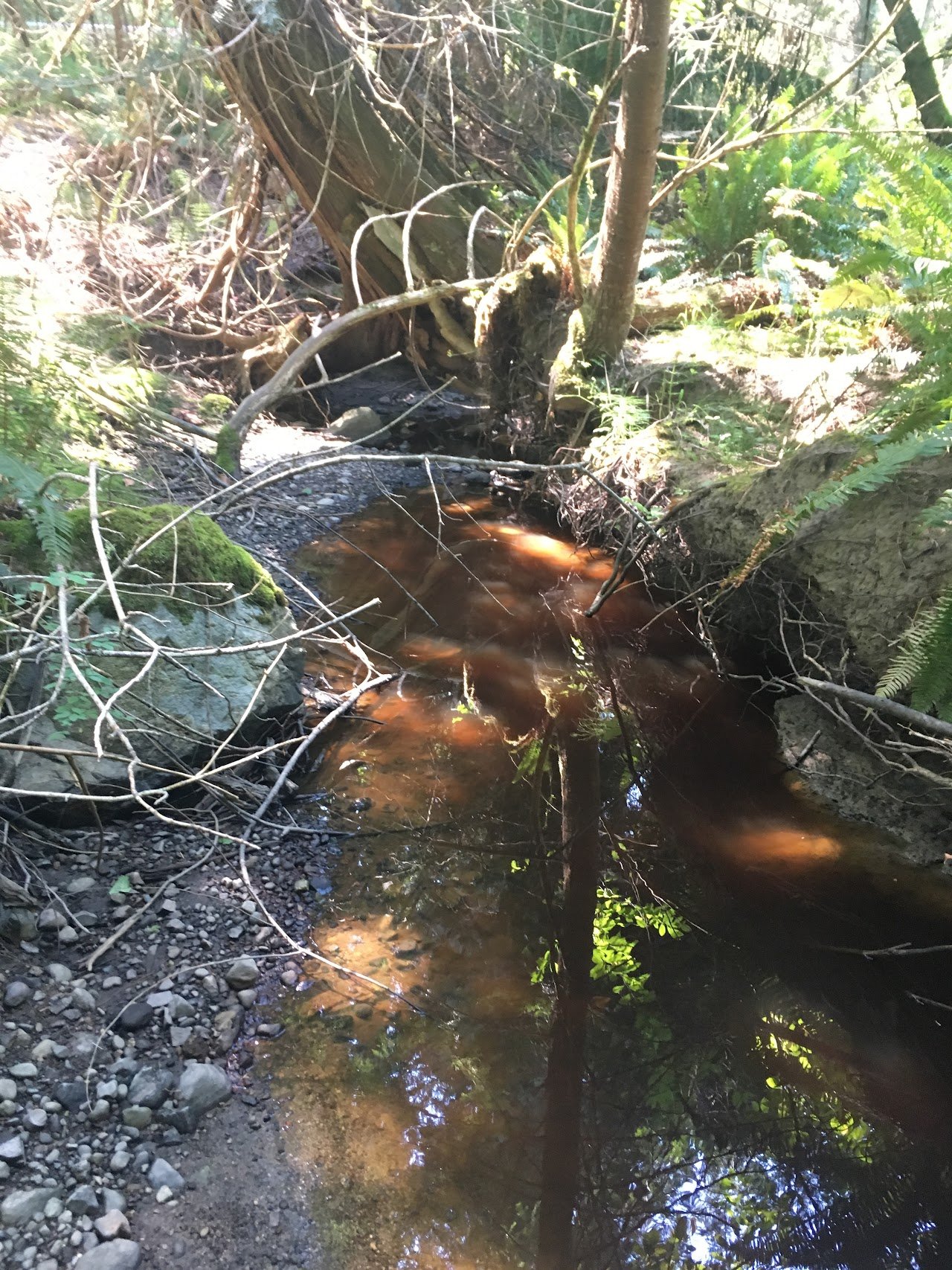
McFadden Creek may be a seasonal (possibly partly groundwater fed?) creek system.
Creek water temperature variability (perhaps showing an inverse relationship with air temperature??) may indicate a groundwater baseflow component to streamflow. However, limited-no flow during summer suggests any groundwater base flow is very intermittent and may be (seasonally) water table dependant...
Conductivities within the creek system are higher than the majority of our island field sites. There are various working models that may explain water temprature fluctuations and the variable creek conductivities and associated in-creek “stressed aquatic system health,” potentially with multiple seasonal and/or other control mechanisms:
immediately prior to no flow, evaporitic/very low flow conditions occurring particularly during shoulder seasons
saline groundwater intrusions (close to a north island area with “salt springs,” potentially localised to faulting/fracture networks?
a local salt spring (or tidal) influx into the creek system (surface/near surface) during times of lower flow (less likely given distances to the coast)
in-creek salinities might be influenced by period fluid flow connections along the striking N-S faults that run through from St Mary Lake to the coast!
Further Reading
Barnett et al., 1993., Salt Spring Island Water Allocation Plan.
Sjuberg, G., 2002., Trust gets earful on estuary plan.
Greenwood, H.J. 2011., Saltspring groundwater in bedrock. A preliminary study for Saltspring Water Council.
McCullough M., 2011., Anadromous Coastal Cutthroat Trout Habitat Reconnaissance. FLNRO.
Manley, D., & Stewardson, M., 2014., Salt Spring Island Riparian Areas Regulation Mapping Project. Mainstream Biological Consulting, sponsored by IT.
IT & SSI Conservancy., 2015., McFadden Creek Nature Sanctuary Property Management Plan Salt Spring Island.
Klassen., J., and Allen, D. M., 2016., Risk of Saltwater Intrusion in Coastal Bedrock Aquifers: Gulf Islands, BC. SFU Department of Earth Sciences.
Gorski, N. G., and Sacre, J. P. (Golder), 2019., Aquifer Mapping and Monthly Groundwater Budget Analysis for Aquifers on Salt Spring Island. BC Water Science Series WSS2019-01, Province of British Columbia.